

Surveyors measure the length of a geological feature such as a coastline or river
by selecting a fixed length d and approximating the feature by a polygonal curve
of side length d. If the approximation consists of N sides, then measured to a
scale d, the length is
An early quantitative assessment of this effect was done by
Lewis Richardson in 1961.
For the coast of Australia and of South Africa, the west coast of Britain, and the
land frontiers of Germany and Portugal, Richardson measured the lengths L(d) using
different scales d, and then plotted Log(L(d)) against Log(d).
In each case,
the data clustered along straight lines, of negative slope, leading Richardson to
postulate the relationship
D = 1.25 for the west coast of Britain, one of the roughest in the atlas,
D = 1.15 for the land frontier of Germany,
D = 1.14 for the land frontier of Portugal,
D = 1.13 for the Australian coast, and
D = 1.02 for the South African coast, one of the smoothest in the atlas.
In 1967 Mandelbrot interpreted D as a dimension and described these geological features as statistically self-similar. That is, each feature belongs to a (possibly infinite) collection of shapes, each of which is made of scaled copies of members of the collection, and the probabilities of selecting a given shape is independent of the number of pieces used to form the shape. Sufficiently fine details, sufficiently far apart, likely become asymptotically independent, so the limiting process to compute the dimension likely converges.
Below are photographs of two oolite shaols in the Bahamas, taken from low orbit. To properly study the fractal character of these features, we should compare photographs taken at different altitudes. Unfortunately, so far grant proposals to study these shoals closeup have not been funded. Click each picture to magnify.
|
|
|
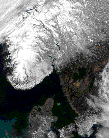
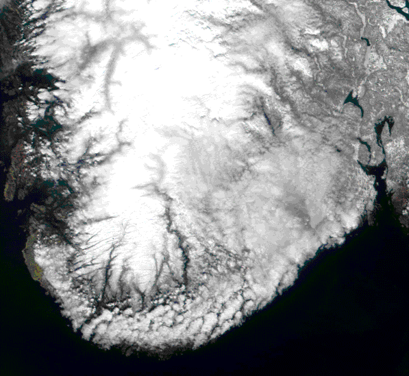
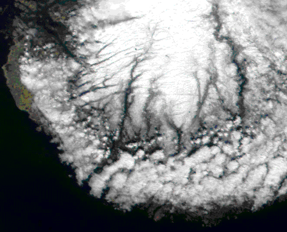
To emphasize that looking more closely reveals more detail, here is are Terra satellite photographs of Sweden (on April 9, 2000), with resolutions of 1.4 km, 500m, and 250m. Click each picture to magnify.
| 
| 
|
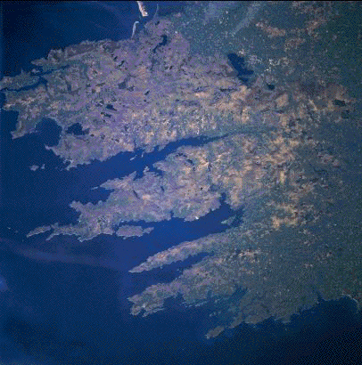
Here is another coastline, this one from England. Click on the image for a zoom, revealing more detail.
|
His work on the ability of fractal drums to damp vibrations led Bernard Sapoval to suggest a mechanism responsible for the fractal form of coastlines. The very small features of coastlines cause turbulence to start at low velocities. Sapoval concludes
"the reason why fractal coastlines exist is precisely because they are best at damping ... waves. As the coast damps down the waves, then the erosion to which it is subjected is reduced. They are thus stabilized by their fractal structure."
In effect, the fractal nature of the coastline evolves to maximum efficiency at damping wave action, so continued wave action is not able to induce qualitative changes in the coastline.